REFRACTORLAND
"Hypertextual Moon Atlas"

 
based on
A. Rükl "Atlas of the Moon"

FRA MAURO

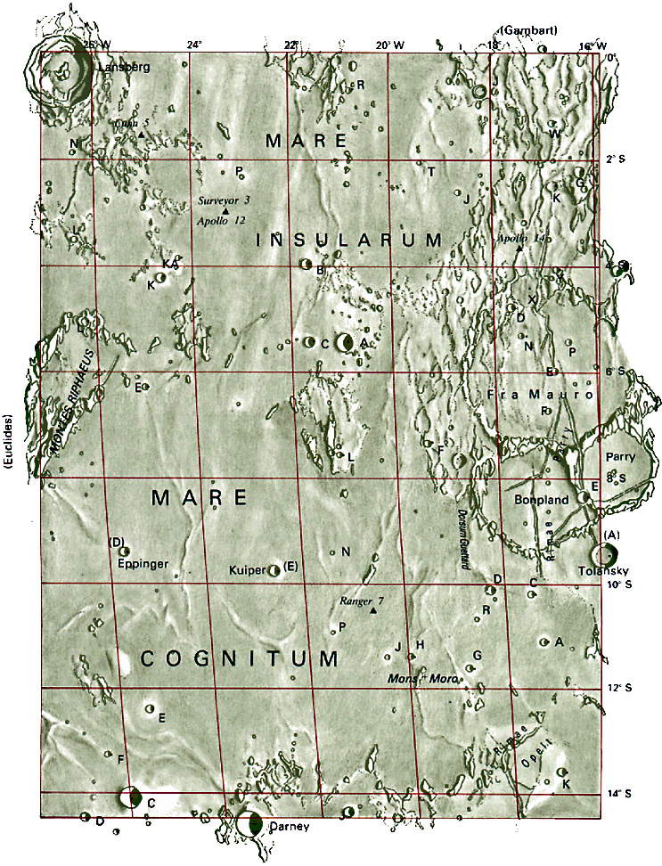
The southern edge of Mare Insularum extends to between the craters Lansberg and Fra Mauro. The lower half of the map is occupied by Mare Cognitum. Although this area is seemingly uninteresting, it contains a number of geologically important locations and therefore was one of the most visited regions of the Moon. This is the area where the probe Ranger 7 crash-landed and where two Apollo expeditions landed: Apollo 12 close to Surveyor 3, and Apollo 14 in the hills outside the rim of the crater Fra Mauro.


North


West 

GoTo

  East


South


42.JPG (16330 byte)


[ Home ]

[ Full Moon Map ]

[ Index of Lunar Features ]

Age of Moon: d. 9

Section 42

RELEVANT FEATURES

  • Bonpland - 60 km
  • Cognitum, Mare - Known Sea
  • Darney - 15 km - h. 2620 m
  • Darney C - 13,3 km - h. 2330 m 
  • Eppinger - 6 km - h. 1250 m
  • Fra Mauro - 95 km
  • Guettard, Dorsum - length 40 km
  • Insularum, Mare - Sea of Isles
  • Kuiper - 6,8 km - h. 1330 m
  • Lansberg - 39 km - h. 3110 m
  • Moro, Mons - length 10 km
  • Opelt, Rimae - length 70 km
  • Parry, Rimae - length 300 km
  • Riphaeus, Montes - length 150 km
  • Tolansky - 13 km - h. 880 m

42.JPG (592980 byte)